Then & Now: Washington Mews

A familiar site to New Yorkers and visitors alike, the charming Washington Mews sits just one block north of Washington Square Park. There are a few street names in New York with the word “mews” attached; this indicates that many, if not all, buildings were originally developed as small-scale horse stables for nearby townhouses. These stables therefore date to the era when horses played a pivotal role in movement around the city, from passenger carriages to delivery trucks and trolleys.
Greenwich Village, as one of the earliest developed neighborhoods in Manhattan, has its fair share of horse stables that have often been converted to residences. There’s even a former horse auction mart in the East Village that became an official city landmark last year!
The collection of two-story buildings at Washington Mews is actually a mix of purpose-built 19th century horse stables on the north side and 20th century residences on the south side, nearest Fifth Avenue. These later buildings replaced the unusually deep rear gardens of the Greek Revival townhouses (famously known as “The Row”) along Washington Square North.

According to the Greenwich Village Historic District Designation Report, the north side stables were built to service the Washington Square North houses that date from 1829 to 1833; their placement on the north side was what allowed for the plentiful garden space behind these elegant townhouses. The report also indicates that, by 1854, six stables had been built on the south side. As such, a number of north side stables were transferred to property owners in townhouses facing West Eighth Street.
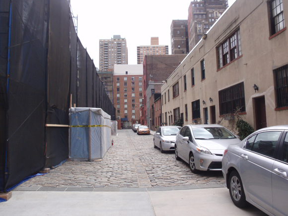
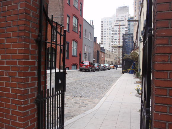
Cobblestones, which are also referred to as Belgian blocks, lined the mews itself. Today, only half of the street (the side closest to University Place) is paved with this historic material; the Fifth Avenue side is finished in cement. The late 1950s (or later) photograph above, from the GVSHP archives, shows that the concrete has been part of the Mews for some time.

The Mews became the home of artists and writers in the 20th century, and therefore continued to play a big role in the changing character of the Village. In 1949, Sailors’ Snug Harbor leased the Mews to NYU. The university retains these buildings today for various uses. Visible in the current photographs is the present-day condition of the street, which has been undergoing renovation work in the past year. For anyone interested in seeing detailed plans of this work that was approved by the Landmarks Preservation Commission, we at Off the Grid wrote a post last May answering the question, “What’s Happening on Washington Mews?”
Unfortunately, the buildings in the historic photograph are hidden behind scaffolding and netting in the current photographs, as part of the renovation work. However, you can still get a sense of the character of the area today.

I came upon a letter and address while researching my Great Aunt, Gertrude F. Boyle Kanno which indicates she was receiving mail at 1 Washington Square, North which when googled seems to be the residence of Edward Hopper. Do the Mews share the same address? or at least in 1915?
Not long after she moved to 246 E 14th in the same building as Margaret Sanger and her sister.
She arrived in New York in late 1915 to join Eitaro Ishigaki who may have been residing at the Mews first.
Hi Rob,
Thanks for sharing this great information! Your Great Aunt had wonderful connections to Village history. The stable facing the Mews did share the same address as 1 Washington Square North in 1915. Here is a link to a map from 1916 that shows this: 1916 Bromley Map.